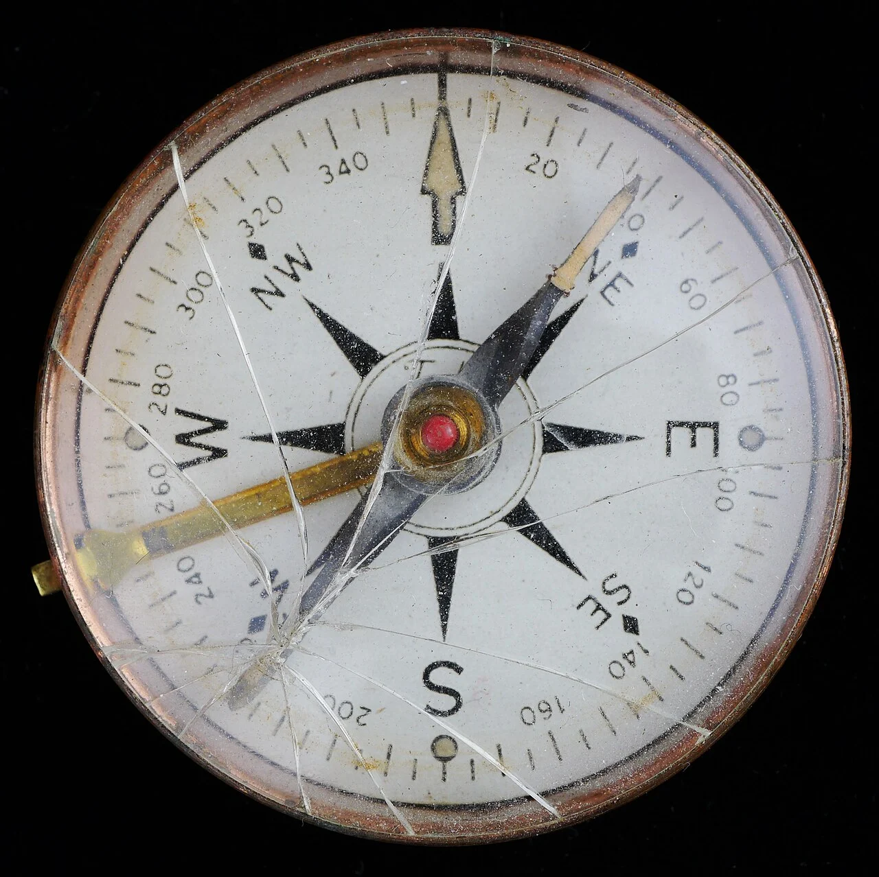
A map can turn on the page while the street relationship stays unchanged. If you read up as both north and the direction ahead, those two meanings can pull apart. Two original fictional route drawings isolate that difference at one corner. They contain no real streets, provider map tiles or GPS information. The comparison explains a paper orientation choice, not a tested navigation app or directions for finding an actual place.
Fix the route before turning the drawing
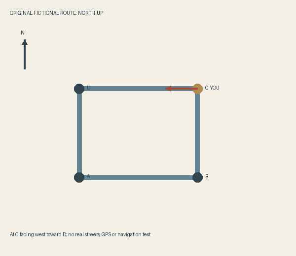
The invented route visits A, B, C and D around a rectangle before returning to A. In its north-up view, A is at the lower left, B at the lower right, C at the upper right and D at the upper left. The current position is C, with the proposed next movement west toward D.
The NWCG Basic Land Navigation guide describes true north at the top as a common map convention. We borrow only that reference for the first drawing. The guide’s field-navigation material is not turned into instructions here, and the fictional rectangle has no scale, geographic location or real-world bearing to verify.
North-up: let the next segment point left
In the first drawing, the north arrow points to the top of the page. At C, the arrow toward D points left. The next direction and the map’s top are therefore different, even though both arrows can be read consistently.
I prefer this view when I want to keep the four corners’ wider relationship stable on the page. The route from A to B remains below the route from D to C. Turning at C does not require redrawing that overview. It does require remembering that the next segment is left on the picture rather than ahead at its top.
If somebody has been treating the page’s top as the way they are facing, that difference is worth noticing. It is not evidence that the person is bad at maps or that a particular display is defective. The drawing is asking them to use a geographic reference instead of a body-facing reference.
Heading-up: turn west toward the top
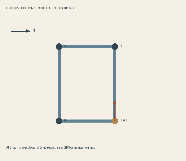
For the second drawing, rotate the first map ninety degrees clockwise on the page. The current position stays C, and the next destination stays D. The C-to-D segment now points up. The north arrow points right because north has rotated with the rest of the map.
The letters make the change inspectable. A is now at the upper left, B at the lower left, C at the lower right and D at the upper right. No corner has been added or moved within the fictional street network. Only the network’s orientation on the page has changed.
This would be my preference for a snapshot focused on that next segment from C. The arrow ahead agrees with the top of the picture. It provides a different convenience from the stable north-up overview; it does not prove that a live heading display will be accurate, timely or easier for every person.
Keep the north reference when the picture changes
The useful question is which reference the display is keeping steady. In our first image, north stays up. In the second, the stipulated direction ahead at C stays up. Calling both simply the right way up hides that choice.
Actual map apps and devices have their own controls and limitations. We have not changed a setting, tested a sensor or compared route accuracy. Do not use the fictional arrow as a navigation aid or assume that one app implements precisely this paper example.
Before paying for a navigation feature or another device to resolve an orientation preference, inspect the actual product’s documented views and suitability for the intended use. The paper comparison can help name the question you want answered, while the real route, conditions and responsible use require their own information.
Sources & further reading
Published sources for the details and examples discussed in this story.